
The Bureau of Meteorology has reported that Tropical Cyclone Maila is anticipated to further weaken and slow down throughout the weekend.
Residents of Queensland can look forward to a warm and sunny weekend, with cooler temperatures expected to arrive early next week.
It is possible that Cyclone Maila will make landfall as a tropical low in the coming week.
Currently classified as a category one system, Cyclone Maila was previously downgraded from category four to category three, and then again to category two just yesterday.
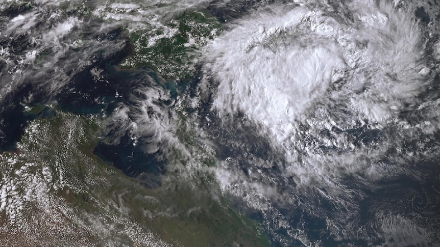
As per the Bureau of Meteorology, Maila is situated approximately 630 kilometers west-northwest of Honiara and about 810 kilometers east of Port Moresby. The cyclone is moving slowly and is expected to continue this trend in the Solomon Sea on Saturday.
There is a chance that Maila will enter the Coral Sea early next week and head toward the coast of Far North Queensland. However, forecasts suggest that it will likely diminish below tropical cyclone strength before making landfall.
Another potential scenario is that Maila could weaken in the Solomon Sea or over southeastern Papua New Guinea this weekend and may not transition into the Coral Sea as a tropical cyclone.
Senior forecaster Shane Kennedy from BOM indicated that any possible landfall would probably occur north of Cooktown in Far North Queensland.
Mr. Kennedy noted that Maila has lost strength due to its recent movement, which involved a slight loop in the Solomon Sea.
When the cyclone resumed its westward trajectory, it brought destructive winds of 200 km/h, causing significant damage to communities in the Solomon Islands, Papua New Guinea, and Bougainville yesterday.
Mr. Kennedy expects that Maila will keep weakening over the weekend. “There’s still a chance for damaging wind gusts and heavy rainfall once it reaches land,” he stated. “Even in a weakened state, we are likely to experience moderate to heavy rainfall across northern Queensland starting Tuesday.”
He emphasized the importance of monitoring the situation, as certain regions in north and Far North Queensland could receive up to 100 millimeters of rain.
“Given the saturation of local catchments, we may also witness some river rises,” he added, noting that a flood watch could be issued over the weekend.
In terms of weather, Mr. Kennedy reported that St George recorded a preliminary maximum temperature of 36.9 degrees Celsius yesterday, setting a potential record for April.
“However, cooler weather is on the horizon,” he remarked. “A trough is currently moving into the far southwest, bringing cooler air across the state in the days to come.”
Until then, the trough will continue to push hot air ahead of it.
Mr. Kennedy forecasted that hot conditions would persist in the eastern and central districts over the weekend, with temperatures reaching nearly 10 degrees above the seasonal average.
He also noted the possibility of a hazardous surf warning for southern Queensland’s coastline, attributed to another ex-tropical system moving toward New Zealand.
Forecasts for Saturday predict Brisbane will reach a high of 33 degrees Celsius, while the Gold Coast is expected to see 30 degrees, and the Sunshine Coast around 31 degrees.